Manchester from the Sky: Aerial Photography for Urban Development
As Manchester continues to grow and evolve, capturing the city from above offers a fresh perspective on its development. Aerial photography, a technique once used primarily for artistic purposes, has now become a valuable tool in urban planning. From monitoring construction projects to improving infrastructure, aerial photography has transformed how cities like Manchester are shaped.
In this post, we will explore how aerial photography is influencing urban development in Manchester, from providing valuable insights for city planners to helping the community understand how their city is changing.
The Importance of Aerial Photography in Urban Development
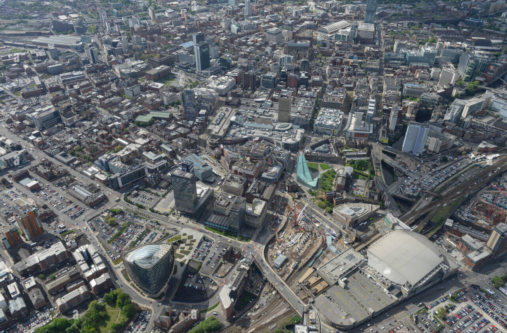
Aerial photography offers a unique viewpoint that ground-level images cannot provide. When it comes to urban development, city planners, architects, and developers benefit from a bird’s-eye view of Manchester’s evolving landscape. High-resolution images captured from the sky offer a complete visual overview of the city, showing everything from major construction projects to smaller-scale developments.
These images help decision-makers assess current structures, identify potential challenges, and plan new projects more accurately. For example, an aerial photograph can highlight the layout of road networks, green spaces, and building densities, allowing for more effective planning of future developments. The accuracy and detail captured in these images also help ensure that projects run smoothly and within the planned scope.
Why Manchester is an Ideal City for Aerial Photography
Manchester is one of the fastest-growing cities in the UK, and its urban expansion has been significant over recent years. With new buildings, transport systems, and housing projects appearing across the city, aerial photography plays a critical role in tracking these changes. The city’s mix of old industrial areas and modern developments makes it an ideal location to benefit from the technology.
Aerial photography offers planners and developers a full picture of ongoing transformations, helping them plan future projects with confidence. From Salford Quays to the Northern Quarter, the changing face of Manchester is best viewed from above, allowing professionals to visualise the current city layout and what it could become.
How Aerial Photography Benefits the Community
Aerial drone photography not only benefits those involved in city planning but also the wider Manchester community. By providing a comprehensive view of the city’s layout, these images help ensure that developments are designed with the needs of residents in mind. For example, aerial images can highlight areas where traffic congestion might become an issue, allowing city planners to design better road systems.
Additionally, green spaces can be more effectively integrated into urban areas using aerial data. Understanding how existing parks and recreation areas fit into the broader urban landscape ensures that future developments are more balanced, with room for leisure and nature alongside new buildings. Residents benefit from well-planned, visually appealing neighbourhoods that have been shaped using the insights gained from aerial imagery.
Applications of Aerial Photography in Manchester
Aerial photography has a range of applications across different sectors in Manchester. In real estate, for example, developers and estate agents use aerial imagery to showcase properties and the surrounding area to potential buyers. For construction companies, aerial photographs provide a clear record of progress, ensuring that projects stay on track and within the approved parameters.
Government and public sector projects also rely heavily on aerial photography. Infrastructure developments such as road expansions, public transport networks, and city-wide environmental initiatives are often planned using data from aerial images. By capturing detailed, up-to-date visuals of Manchester, city planners can make informed decisions that benefit everyone.
Aerial Photography for Future Planning
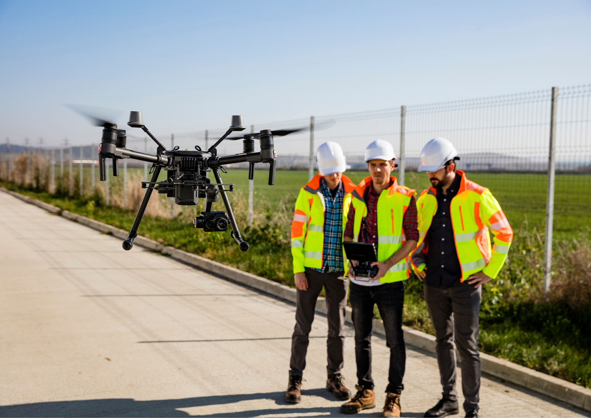
As Manchester’s urban development continues, drone aerial photography will remain vital in shaping the city’s future. The technology provides planners with the up-to-date information they need to design modern, sustainable urban spaces. From large-scale commercial developments to housing estates, aerial photography will guide decision-makers in planning the city’s future growth.
The ability to monitor ongoing projects from the sky ensures that any potential issues are spotted early, saving both time and resources. As technology advances, the quality of aerial images will only improve, making them an even more valuable asset for urban development in Manchester.
Aerial photography plays an essential role in Manchester’s urban development. It provides city planners, architects, and developers with the detailed visuals they need to make informed decisions that shape the city’s future. From construction projects to improving public spaces, aerial photography offers a comprehensive view of how Manchester is changing and growing.
As Manchester continues to expand, drone photography will remain a crucial tool in guiding its progress. If you’re interested in learning more about how aerial photography can benefit your project, get in touch today and see how we can support you.
When it comes to aerial photography in Manchester, choosing the right company is essential to getting the best results. Aerial Photography Manchester is the top choice for developers, architects, and city planners due to our commitment to delivering high-quality images that capture every detail. With years of experience in Manchester’s urban development projects, we understand the unique challenges and opportunities of working in this vibrant city. Our advanced technology ensures clear, precise images every time, and our team is dedicated to supporting your project from start to finish. Whether you’re planning a new development or need progress shots for an ongoing project, Aerial Photography Manchester has you covered.
Check our new GBP update about
aerial photography for urban development in Manchester.