Aerial Photography
Drone Photography
At Aerial Photography Manchester, we specialise in capturing the world from a unique and captivating perspective. Our mission is to provide you with breathtaking aerial photography that transforms ordinary views into extraordinary moments. With a passion for photography and cutting-edge drone technology, we have become the go-to choice for aerial photography services.
Whether you need an aerial photoshoot for a memorable day or want to capture the progress of a construction site from start to finish, we can help. We offer more than just stunning pictures from the sky; we provide a versatile and valuable tool that can be used across multiple industries and purposes. Our mission is to elevate your perspective and empower your projects with high-quality drone photography.
Aerial photography is a game-changer in various sectors, including construction, real estate, and surveying. It allows you to gather information quickly, cheaply, and safely, which means you can gain insights, make informed decisions, and capture visual data like never before.

Why Choose Us For Your Aerial Photography?
Unparalleled Expertise
Our team of skilled aerial photographers has years of experience and intimate knowledge of the area. We are familiar with the airspace and know how to get the best angles. This expertise allows us to deliver remarkable
aerial imagery that suits your needs.
Cutting-Edge Drone Technology
At Aerial Photography Manchester, we embrace innovation. Our state-of-the-art drones have high-resolution cameras, ensuring every shot captures intricate details. Whether it's a construction project, a real estate endeavour, or an inspection task, our technology guarantees precision and clarity.
Competitive Pricing
Aerial Photography Manchester believes in providing exceptional value for your investment. We understand that cost-effectiveness matters, whether you're a business owner, an event organiser, or an individual looking to capture memories forever. Our competitive pricing ensures you get the best results at affordable rates.
Efficient Turnaround
We recognise the importance of timeliness in your projects. Our streamlined processes and experienced team enable us to promptly deliver your aerial photography results, empowering you to make timely decisions and enhance your workflow.
Customised Solutions for Diverse Industries
We understand that aerial photography serves various industries and purposes. We work closely with you to tailor our services to your needs. Our versatile solutions can provide valuable insights and visual data regardless of your field.
Safety at the Core
Safety is our first concern. We strictly adhere to safety protocols and regulations, including airspace restrictions, to ensure the well-being of our clients and the public. Our commitment to safety means you can confidently integrate our aerial photography services into your projects without worry.
What Is Aerial Photography?
Drone aerial photography is a specialised form of photography that involves capturing images or videos from an elevated perspective using unmanned aerial vehicles (UAVs) or drones, as they are known. Unlike traditional ground-level photography, drone aerial pictures offer a unique bird's-eye view of landscapes, buildings, and objects. This innovative approach has revolutionised various industries and opened new possibilities for capturing stunning imagery.
How are Aerial Photographs Taken?
Drone photography offers a fresh perspective that was once only achievable through manned aircraft. This innovative approach allows us to capture stunning images and videos while navigating the skies using unmanned aerial vehicles or drones. Understanding how drone aerial photography works is critical to appreciating its precision and versatility.
How Does Aerial Photography Work?
Client Consultation
Every successful drone aerial photography begins with a thorough client consultation. We take the time to understand your objectives, whether documenting an event, monitoring a construction site, inspecting infrastructure, or any other purpose. Your goals shape the entire process.
Risk Assessment
Safety is paramount in drone aerial photography. We conduct a meticulous risk assessment, identifying potential hazards and challenges for your project. This assessment ensures that the mission proceeds smoothly while adhering to safety regulations.
Airspace Checking
Before taking flight, we check the airspace thoroughly to ensure no conflicts with manned aircraft or restricted zones. Our commitment to safety extends to meticulous airspace management.
Pre-Flight Planning
Precise planning is crucial. We determine optimal flight paths and altitudes to capture the shots you desire. Our pre-flight planning includes weather conditions, time of day, and any specific environmental considerations.
Drone Deployment
Once the plan is in place and safety checks are complete, we deploy our advanced drones with high-resolution cameras. These drones are agile, versatile, and capable of capturing high-resolution imagery.
Aerial Photography Execution
Our experienced drone operators ensure that the drone captures the desired shots during the flight. Our technology allows for exceptional precision, whether it's panoramic views, close-ups of structures, or sweeping landscape shots.
Post-Processing
After capturing the aerial photographs, we carefully process the images and videos to enhance their quality. Our post-processing techniques ensure that you receive the highest-quality results.
Delivery
The final step involves delivering the aerial photographs to you. Whether it's for marketing, documentation, analysis, or any other purpose, we ensure you receive the work efficiently.
What Are The Benefits of Drone Aerial Photography?
- Cost-Effective: Drone photography is a cost-effective alternative to traditional manned aircraft photography.
- Precision: Drones provide our aerial photographer precise control over positioning and altitude, resulting in sharp, detailed imagery.
- Versatility: Drones can navigate challenging terrains and capture shots from various angles, offering versatility in photography.
- Efficiency: The process is efficient, allowing for rapid deployment and timely results.
- Safety: Drone aerial photography minimises risks associated with manual visual inspections such as whilst balancing on scaffolding.
Aerial Photography Manchester's commitment to safety, meticulous planning, and client-focused approach ensure that every drone aerial photography project is executed flawlessly, delivering results that exceed your expectations.
Who Uses Aerial Photography?
Construction
Drones monitor construction progress, assess site conditions and aid project management with precision and cost-efficiency.
Real Estate
Drone photography provides a comprehensive view of properties and their surroundings, enhancing marketing for real estate professionals.
Inspections
In industries like infrastructure, utilities and refurbishments, drones perform safe and detailed inspections of structures, ensuring safety and maintenance.
Tourism
Aerial photographs captured by drones create captivating promotional materials that entice travellers to explore tourist destinations.
Our aerial p will handle your entire project, efficiently and hassle free!
Event Documentation
Drone photography offers dynamic aerial views of events, enhancing marketing and creating lasting memories.
Surveying
Drone photography revolutionises surveying by providing efficient and precise aerial data collection for property and land surveyors and cartographers.
The Importance of Aerial Photography
Aerial photography, advanced by the capability of drones, has revolutionised various industries. Using drones significantly enhances safety, reduces costs, and ensures efficiency. For example, traditional inspection methods often involve climbing scaffolding to assess chimneys, roofs, or other structures. With drones, these risks become obsolete. Aerial drones can access difficult-to-reach areas and capture detailed visuals without exposing workers to potential hazards. This safeguards human lives and removes the chance of accidents and injuries. It also means that
drone aerial photography offers a cost-effective solution. One example is removing the need for expensive scaffolding in the inspection or survey process. But also, quick deployment and low running costs allow for affordable capture of events and occasions via
drone aerial view. It optimises resources, ultimately leading to improved project outcomes and substantial savings, meaning endless possibilities.
How Much Does Aerial Photography Cost?
When considering aerial photography, it's essential to understand the associated drone photography cost. The aerial photography cost can vary depending on several factors, including your specific requirements and the project's complexity. Here's a breakdown of the cost considerations when using Aerial Photography Manchester:
Location
The geographical location of your project significantly affects costs. Aerial photography in remote or challenging terrain may require more time and resources.
Complexity
The complexity of your project, including the required shots and angles, can influence costs. Projects requiring intricate or specific shots will take longer and may incur higher drone photography prices.
Delivery
The timeframe in which you require the aerial photographer to get you the images may change the cost. Requesting a quicker turn turnaround may cost extra.
Flight Time
The duration of the flight is a critical factor. Longer flights may result in higher costs, requiring more drone operating time and potentially multiple flights. Longer flights may be required if you want more photos or a longer, more intricate video.
Drone Type
Different drone models have varying capabilities and costs. Some drone services, such as aerial mapping, require specialised equipment and licenses. We assure you that we have the right aerial photography UAV for the job.
Post-Processing
Post-processing and additional editing services can add to the cost. This includes tasks like image enhancement, retouching, and video editing.
By considering these factors and discussing your project's requirements with our professional aerial photography operators, you can comprehensively understand the costs involved. This will enable you to make informed decisions and budget effectively for your air photography project.
How Much Does Drone Photography Cost?
All of our aerial photography is done by drone so our drone photography rates are the same as and depend on the same factors as our aerial photography prices above.
What Can Aerial Photography Be Used For?
Aerial photography, particularly when harnessing drones, has a wide range of applications across various industries. Here are some key uses:
Aerial Photogrammetry
Aerial photogrammetry is a powerful technique for creating precise 3D maps and models from aerial images. It finds applications in drone land surveying, urban planning, and environmental monitoring. Using drones equipped with high-resolution cameras, we can capture the necessary imagery to generate accurate and detailed photogrammetric data.
Aerial Beach Photography
Regarding tourism and coastal destinations, aerial beach photography is a game-changer. Drones can capture spectacular aerial views of beaches, shorelines, and resorts. These images are used in promotional materials, travel brochures, and online content to showcase the beauty of coastal areas and attract visitors. They can also be used to assess the ecological changes over time.
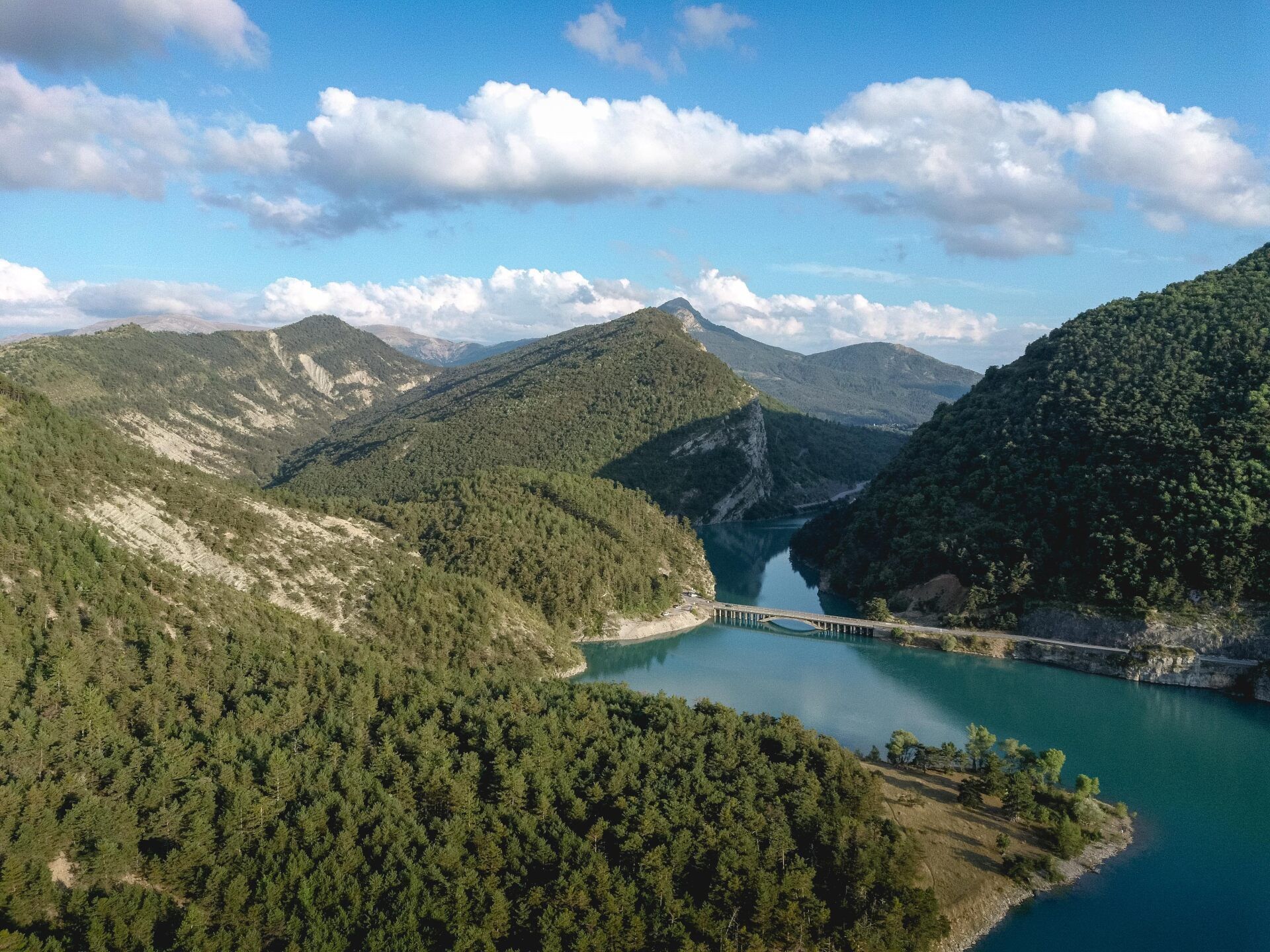
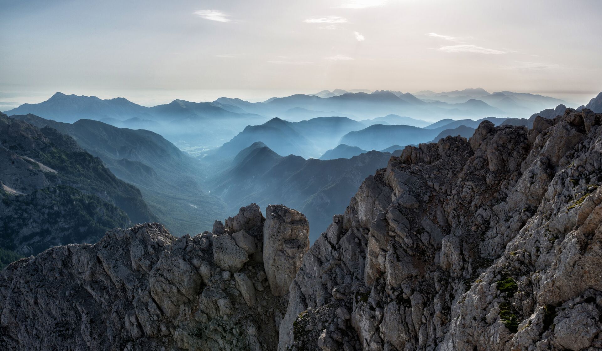
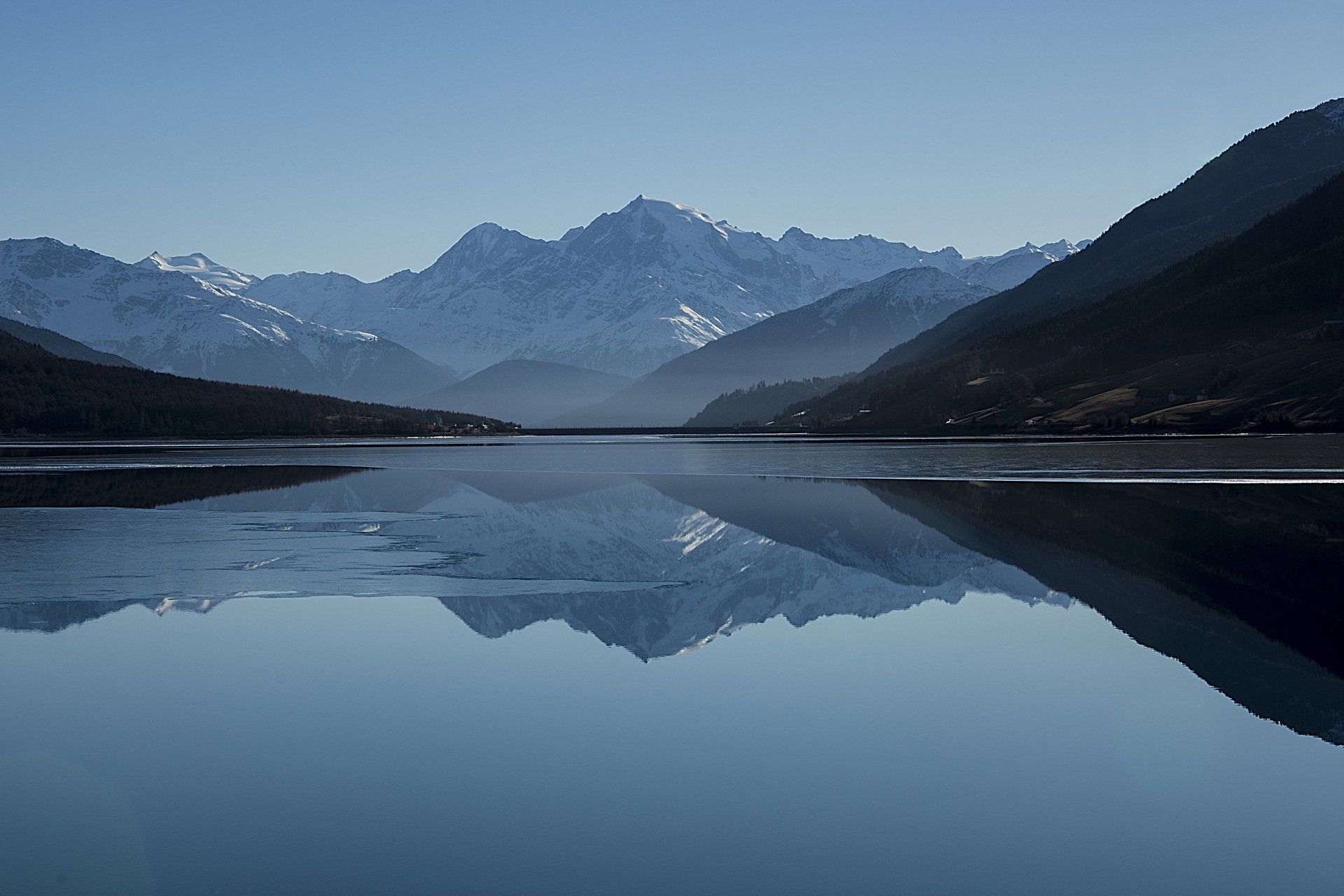
Drone Landscape Photography
Drone landscape photography opens up a world of creative possibilities. Our
aerial landscape photography drone has advanced cameras to capture stunning views, natural landscapes, and scenic beauty from the sky. Whether for artistic purposes, environmental monitoring, or simply appreciating the Earth's beauty,
landscape drone photography offers a unique perspective. There really is nothing that can match our
drone landscape photos.
Drone Property Photography
In the real estate sector, drone property photography, or drone house photography, is indispensable. It allows potential sellers and agents to paint a breathtaking view of the property, helping sales efficiency and boosting value. Drones capture the exteriors, interiors, and surroundings, making listings more attractive and lucrative.
Professional Drone Photography
Professional drone photography serves a broad spectrum of industries. It encompasses services ranging from aerial marketing campaigns to capturing stunning visuals for documentaries and advertisements. The skill of our professional drone photographers combined with high-quality cameras makes them valuable tools for professional photographers and filmmakers.
Drone Wedding Photography
Drone wedding photography offers a unique perspective on your special day. Capture stunning aerial views and dynamic shots to make your wedding memories unforgettable. We also offer drone wedding videography if you truly want to capture every moment.
Drone Inspection
Drone technology has revolutionised inspections, providing safer and more efficient alternatives. Whether it's a
drone roof inspection or
drone surveying, the advantages are huge. Drones equipped with high-resolution cameras capture detailed images, eliminating the need for risky manual assessments. We cover infrastructure, utilities, residential and industrial facilities, accessing hard-to-reach areas with specialised sensors.
UAV inspection offers safety, precision, and cost-effectiveness, streamlining inspections across industries for efficient assessment and maintenance.
Oblique Photos
Oblique photos refer to images captured at an angle where the camera is tilted or slanted relative to the subject or the ground. These photos provide a unique and dynamic perspective compared to traditional vertical or orthographic shots. Oblique photography with drones is a powerful technique that adds depth and context to aerial imagery.
High Oblique Photos
In high oblique photography, the camera is tilted at an angle while capturing a subject or landscape. This angle often includes a significant portion of the sky in the frame, creating a sweeping and encompassing view. High oblique photos are excellent for showcasing wide areas, highlighting landscapes, and providing a sense of scale.
Low Oblique Photos
Low oblique photography involves tilting the camera at an angle but with a focus on the ground or the subject. These shots typically include more of the ground or the objects below and less of the sky. Low oblique photos are ideal for an aerial photoshoot emphasising specific features, such as buildings, terrain details, or points of interest.
Both high and low oblique photos offer a fresh perspective that enhances the visual storytelling capabilities of drone photography. They can be used effectively in various industries, including real estate, construction and tourism to provide viewers with a captivating and immersive experience. We have a photographer with a drone that can help get the perfect angles.
What Are The Disadvantages Of Aerial Photography?
While aerial photography offers numerous benefits, it does come with certain limitations. Firstly, the quality of the pictures in the drone photoshoot can be impacted by weather conditions and the time of day. Unpredictable weather can hinder flights and affect image clarity. Additionally, extreme conditions may render drones incapable of flying due to safety concerns. Moreover, airspace considerations are essential, as drones must adhere to regulations and avoid restricted zones. These limitations underline the importance of careful planning and flexibility when engaging in aerial photography to overcome potential challenges. However, our aerial photographers are very experienced and adept at providing excellent drone photography, even in challenging conditions.
Locations Where We Provide Aerial Photography
List of Services
-
Manchester
Manchester
-
Salford
Salford
-
Urmston
Urmston
-
Sale
Sale
-
Timperley
Timperley
-
Altrincham
Altrincham
-
Wilmslow
Wilmslow
-
Knutsford
Knutsford
-
Northwich
Northwich
-
Macclesfield
Macclesfield
-
Buxton
Buxton
-
Stockport
Stockport
-
Oldham
Oldham
-
Rochdale
Rochdale
-
Bolton
Bolton
-
Bury
Bury
-
Wigan
Wigan
-
Leigh
Leigh
-
Congleton
Congleton
-
Crewe
Crewe
-
Nantwich
Nantwich
-
Sandbach
Sandbach
-
Chorley
Chorley
-
Glossop
Glossop
-
Marple
Marple
-
Prestbury
Prestbury
-
Lymm
Lymm
-
Hyde
Hyde
-
Ashton-under-Lyne
Ashton-under-Lyne
-
Stoke-on-Trent
Stoke-on-Trent
-
Warrington
Warrington
-
Preston
Preston
-
Blackburn
Blackburn
-
Huddersfield
Huddersfield
-
Atherton
Atherton
-
Middleton
Middleton
-
Denton
Denton
-
Chadderton
Chadderton
-
Romiley
Romiley
-
Radcliffe
Radcliffe
-
Ashton-in-Makerfield
Ashton-in-Makerfield
-
Heywood
Heywood
-
Farnworth
Farnworth
-
Stalybridge
Stalybridge
-
Hindley
Hindley
-
Cheadle Hulme
Cheadle Hulme
-
Golborne
Golborne
-
Westhoughton
Westhoughton