Using Drones for Agricultural Monitoring and Crop Management
In modern agriculture, advanced technologies like drones have revolutionised how farmers and agronomists manage crops and monitor farmland. Drones, especially when equipped for
aerial photography, have become invaluable tools for efficient and effective agricultural practices. This transformation is particularly evident in regions where aerial photography integrates seamlessly with agricultural needs, providing comprehensive insights into crop health and land use.
The Rise of Drone Technology in Agriculture
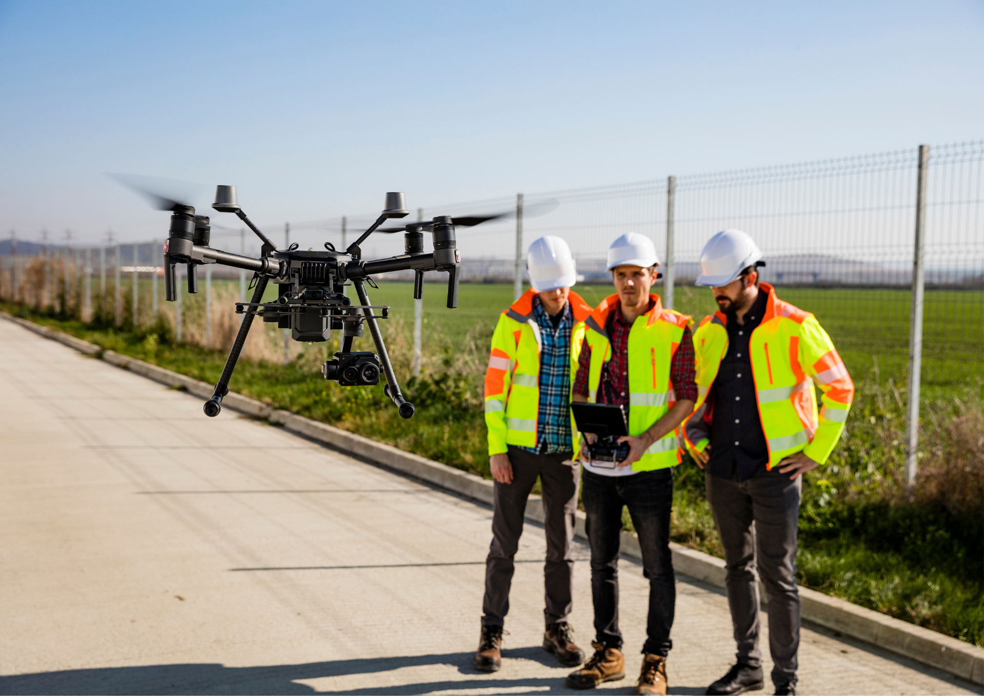
Integrating drones into agricultural practices marks a significant shift from traditional farming methods. Drones, or unmanned aerial vehicles (UAVs), equipped with aerial photography capabilities, offer a bird' s-eye view of vast expanses of farmland, delivering critical data that was once difficult or impossible to obtain. This technology facilitates precise and timely decision-making in crop management.
Precision Agriculture and Crop Monitoring
One of the key benefits of using drones in agriculture is precision agriculture— a farming management concept based on observing, measuring, and responding to variability in crops. Through high-resolution aerial photography, drones capture detailed images that reveal variations in soil properties, moisture levels, and crop health. This information enables farmers to implement targeted interventions, optimising resource use and maximising crop yield.
Efficient Resource Management
Drones also play a crucial role in resource management. By obtaining
aerial photoshoots of farmland, farmers can assess the condition of their crops and soil. This data aids in the precise application of water, fertilisers, and pesticides, reducing waste and minimising environmental impact. Drone technology ensures that resources are used judiciously, supporting sustainable farming practices.
Case Studies: Success Stories in Manchester
Several success stories highlight the impact of drone technology in agriculture. Local farmers have embraced
drone photography for regular monitoring of crop health, leading to timely interventions and improved yield. These case studies demonstrate how aerial photography has become a game-changer in detecting pest infestations, nutrient deficiencies, and water stress conditions, allowing for rapid response and management.

Future Prospects and Challenges
The future of drones in agriculture is promising, with ongoing technological advancements paving the way for more sophisticated applications. However, challenges such as regulatory hurdles, high initial investment costs, and the need for technical expertise must be addressed to fully realise drones' potential in agricultural monitoring and crop management.
The integration of drones, particularly for aerial photography, in agricultural monitoring and crop management is transforming the industry. The benefits of this technology, including enhanced precision, efficient resource management, and informed decision-making, are clear. As we move forward, the continued adoption and evolution of drone technology will undoubtedly shape the future of agriculture.
Aerial Photography Manchester stands as the top choice for anyone seeking drone service in Manchester. If you find yourself seeking a professional aerial photographer, look no further! Contact us today and our team will respond to your inquiries promptly.
To know more, read our latest GBP update about integrating drone photography for agricultural monitoring and crop management.